Showing posts with label Coleman Mountain. Show all posts

Wednesday, August 7, 2013

HERE WE GO!

It is 10 days and counting until the 4th Annual Blue Ridge Breakaway on August 17th at beautiful Lake Junaluska in Western North Carolina. Our planning processes are ramping up for the final few days leading into another exciting event.

BreakawayUpdatedWebAd2013

Planning for this event began at the end of the day of last year’s event, so it isn’t a stretch to say…

Wednesday, November 14, 2012

THE QUESTION OF THE DAY…


ZekeMeetsAndy

Zeke meets Andy!

So, here is today’s question. What happens when two motorcyclists meet by a garbage dumpster? (No, this isn’t a slam on motorcyclists – I’m one myself!) The story behind the answer goes like this…

Wednesday, September 5, 2012

I GOT DEM HOUSE BUILDING BLUES!

I’ve been a little crazy lately characterized by bad eating, bad sleeping, and no riding. I can pretty much talk with you coherently about 24” base cabinets, 3 1/2” crown molding, and the proper length of a tail line for a septic system. I’m no longer as up-to-date in the world of cycling as I was and want to be. In fact, I had a dream…

Monday, August 20, 2012

WHEW! IT IS DONE…

The 2012 Blue Ridge Breakaway has rolled to a close. The signs are collected and, in the case of Russ Roca and Laura Crawford of The Path Less Pedaled, the wheels are up! As I type Russ and Laura should be winging their way home to Portland.

Russ Roca and Laura Crawford entertain crowd

(Laura Crawford and Russ Roca entertain the Blue Ridge Breakaway participants!)

We said our goodbyes at the Greenville/Spartanburg, SC jetport after a brief stop…

Friday, April 13, 2012

LET THE GOOD TIMES ROLL!

April 13, 1944

From the daily diary kept by S.Sgt. G.C. Watts, while stationed in Italy during WWII… “We got 3 new planes in for repair. One shot up completely. Bill and I develop 7 rolls of films but no printing paper .”

The week has been busy since our return from the Low Country of S.C. On the cycling front, I participated in the Haywood Community College Spring Fling on the 11th. Along with fellow Council member, Claire Carleton, we attempted to survey HCC students on their interest in having the multi-modal connector developed between campus and the Town of Clyde.

HCC Students completing survey!

(HCC students complete survey regarding multi-modal path.)

Dogwood Winter was in full force on the very clear, very cool day…

Monday, August 23, 2010

BLUE RIDGE BREAKAWAY REVIEW, PART II


Part one of the ride of the inaugural Blue Ridge Breakaway.


When last I left you, Wolfpen Andy and I had just enjoyed a nice long train ride behind a tandem and 3 cyclists and were making the right hand turn onto Coleman Mountain Road and the first moderate climb of the day for all routes of the Blue Ridge Breakaway

After crossing Jonathan Creek on Coleman Mountain, we were still riding along behind the “train” and beginning the very early rise of the climb to the peak above I-40. I was still on last wheel and then, I wasn’t… The tandem and accompanying cyclists, including Wolfpen Andy, were still motoring on up the mountain at a pace I knew I wouldn’t survive and get to the top. I quickly dropped back into my Kent “Mountain Turtle” Peterson personae and began to “hasten slowly”. 

Coleman Mountain has a couple of small inclines and dips before the main part of the climb begins and you cross under I-40 before making a right hand turn to a straight stretch leading to the top. Wolfpen Andy had dropped from the “train’s” wheels and we rejoined just as we went under I-40. I saw my first cyclist of the day on the side at that point. This person had popped just before the underpass, which is about 1/3rd of the way up the climb.

As we made our way to the top, some distance had opened between myself and Wolfpen Andy and I decided to go ahead and begin the winding descent to Iron Duff Road intending that we would hook up again at that point. The top of Coleman on the Iron Duff side has about 5 curves in the top half and is rather serpentine around the point where Jack Pine Drive joins to Coleman Mountain. I had good speed going down and did not have to avoid other cyclists as there were none in front of me. The tandem train was long gone and I was not to see them again.

I was enjoying the descent but got just a wee bit hot into one corner and my heart jumped up into my throat as I tried not to panic and trust the bike. All worked out well and I finished the descent with good speed. At the intersection of Coleman Mountain and Iron Duff Road, I checked for Wolfpen Andy but he was no where to be found.

(Note: In a phone call Saturday evening, Wolfpen Andy told me was descending Coleman behind me when a cyclist blew past him and was way too hot for the curve at Jack Pine. He lost control and went off the road into the bank and assorted bushes, vines, and trees. Wolfpen Andy stopped to check on him and help him to the side of the road. He stayed with him until the motorcycle support arrived before he resumed his ride of the 40 miler.

My best friends live on Jack Pine and I was telling them about the accident at their drive. Nick said he was glad that the cyclist wasn’t hurt seriously but that he’d have to wait for 2 to 3 days to see all of the outcome of that crash. Being familiar with the specific bank and location, Nick advised that it was full of poison oak! Our fallen comrade may be itching up a storm by the time you read this!)


Betwixt and Between seemed to become my theme for the remainder of the ride from this juncture. I rode the full descent to the Pigeon River and the right hand turn onto Riverside alone having no cyclists behind nor in front of me. It was pretty much a solo adventure for the rest of the day. I made my way up Riverside and enjoyed the smells of barbecue being cooked along the way and then made my way up Crabtree Church Road before coming upon a lone cyclist making his way to the top. Just before the peak of the short climb, we were greeted by fans 3 deep along the side of the road cheering us on. Well, actually, it was a father and his two daughters and he was standing behind the two of them. Still, they did cheer us on!

Crabtree Church Rd. intersects with NC 209 and the first water stop of the day was immediately on our right at Crabtree United Methodist Church. All routes of the ride were to come by this position so it was a large stop manned by many volunteers. Everyone was greeted warmly and volunteers offered to hold bikes while the participants refreshed themselves with food, drink, and visits to the portajohns.

Zeke's Fuji CCR3 in good hands!


(Friendly volunteer watching over my bike!)

Crabtree FUMC water stop


(The first aid station of the day laid out with goodies!)

The first of the Century riders had not made it to this point as I departed but we were  soon joined by the young man on his 18” bike referenced in part one of this story. He was still going strong! I’m not sure he had worked up a sweat at this point.

After a short break and refresher, it was back to the course. I followed out two cyclists, who were unfamiliar with the course. As we pedaled along NC 209 to Golf Course Road and then Big Branch, I gave them a short introduction to the remainder of the 60 mile route. In short order, we were climbing up the backside of Hyder Mountain Road and I found myself again riding solo. I recall a nice greeting from a resident as he was putting out his American flag on his second floor deck. Topping Hyder Mountain was a moderate climb leading to a steep downhill descent and the Pigeon River. It was at this point, the 40 milers and 25 milers would return to Lake Junaluska. The century riders and metric century participants turned east on Hyder Mountain Road and spun along the riverbanks of the Pigeon to Clyde, NC where the second aid station of the day was located.

It was at this point that I found out about what appeared to initially be a serious accident. Riders were required to stop at all traffic signs/lights and this location was a major intersection of travel from Waynesville to Canton. A rider had stopped at the traffic light in order to cross over Carolina Boulevard and begin the approach to Stamey Cove. It is unclear to me exactly what happened at the traffic light but the most common report that I’ve received is that a truck pulling a horse trailer pulled up on the left of the cyclist. When the light changed, the truck proceeded to turn right in front of the cyclist and shortened the turn dragging the horse trailer across the curbing and pulling the cyclist under the trailer.

It is not clear at this point why the truck driver proceeded as he did and I do not know whether he was charged with any traffic offense. The good news is that the rider was transported to the hospital and treated for abrasions and other non-life threatening injuries. He was later released and was reported to be home and doing well on Sunday.

The next section of the ride was the most difficult climb for the metric century riders. Well, to be more accurate, it was 50% of the most difficult climb because the planners of the route had us climbing Stamey Cove on the outgoing leg and on the return leg. The two sides are both difficult although their characteristics are different. Along this short stretch before the climb began, I enjoyed a brief conversation with a cyclist, who was riding in support of her friend. The friend was struggling mightily at this point and we had not yet arrived at the climb. We soon parted ways and I made my way up the initial steep climb. On the Clyde side of Stamey Cove, you have an initial steep climb into a left hand hairpin turn and then a LONG steady climb to the top.

I was just short of approaching the hairpin curve when I heard “on your left” for the first time in quite awhile. It turned out to be the lead pack of century riders. I was “hastening slowly” up the mountain and they passed me like I was standing still, which wasn’t far from the truth. It was a humbling experience to be passed so easily on such a steep climb. They were gone and out of sight rather quickly leaving me to my solo ascent of the climb free to wonder if I could have ridden at that pace in my 20’s.

The gap was in sight and I was again greeted by a local resident, who was leaning over the deck of her railing and appeared to be enjoying the morning. I inquired as to her state of being and she inquired as to mine. We both agreed she probably felt better than I did at that moment! The gap was soon under my wheels and I was shifting to the big ring looking for some speed downhill.

The descent to the Pigeon River was swift and fun and my legs were able to recover nicely. A short run up NC 215 and then across Wells Road soon brought me to NC 110 about one half mile short of the third aid station. At this point, we had run along and over the Pigeon River at least 3 times since beginning the route. Soon enough I pulled into the local Church of God parking lot and the aid station where the Navigator was working.

Zeke and the Navigator(Getting my 24 mile (or so) hug from the Navigator) 

A local Girl Scout troop(?) was greeting riders at the entrance to this aid station with signs and lots of energy. The aid station was slightly below road grade and difficult to see without the presence of the Scouts. The Navigator told me later that a gentleman of Hispanic heritage saw the girls and thought it was a car wash. He pulled in and was trying to inquire about getting his car washed. Unfortunately, his English was worse than the Navigator’s Spanish. I’m sure it was an interesting attempt at conversation before he finally figured out he wasn’t getting his car washed!

After a short break and pick up of my water bottles from the Navigator, I was back on the route and headed to the aid station at Lake Logan, which was the turn around point for the metric century riders. It was along this next section after the Church of God aid station that I would begin to see the first of the returning metric century riders leaving me to ponder my relative position among riders on the metric century ride.

I was lucky to catch the rear wheel of 3 riders doing the century route and benefitted from their pull the rest of the way to the NC 110 and US 276 intersection and the beginning of Love Joy Road. As we started a short climb, I knew my time with them was over and said my good-byes and thanked them for the pull…

(In part 3 of my report, I’ll cover the return trip to Lake Junaluska, the most serious crash of the day, a dramatic change in weather, and oh yeah the post race rescue efforts that were made…)

Until later,

- Zeke

Sunday, August 22, 2010

INAUGURAL BLUE RIDGE BREAKAWAY IN THE BAG!

As I sip on my first cup of coffee of the day and rewind the events associated with yesterday’s first ever Blue Ridge Breakaway, I’m finding it hard to locate a place in the story to start. Not only was it the first ride held in Haywood County in many, many years but it was my first effort at a metric century. Successful completion of this event has been one of my goals for this riding season.

This morning, I am sore and stiff. I have a headache, my lower back objects to any bending at the waist, and my knees pretty quickly second any objections made by other parts of my body when I try to move. I love it! I take it as a sign that I rode hard and didn’t leave anything on the course.

Yesterday’s ride culminated in many months of work by a vast group of volunteers. The Haywood County Chamber of Commerce was the driving force behind the ride as they hoped to bring in cyclists to our area. As I’ve said many times, we are blessed with some excellent riding country here in Western North Carolina. The Chamber was joined by other community volunteers including BicycleHaywoodNC, our local bike advocacy group, Rotarians, Girl Scouts, and numerous businesses that hosted and “(wo)manned” water stops.

The ride incorporated almost all of the geographic region of Haywood County when you look at the routes. Other than the main retail centers of Waynesville and the very eastern end of the county around Canton, roads had to be blocked, cleaned, and security provided. It would be interesting to know the cumulative total of miles covered by this ride.

Planners of the event had hoped for 200 riders. As of mid-day on Friday, the registration was at 240 and there were still about 5 an hour coming in via the website. We also knew there would be some last minute walk-ins. 300 riders was not looking like it would be a stretch by 4:00 p.m. on Friday.

The weather forecast for Saturday had been all over the board throughout the week. One day we were at 20% chance of rain and the next 50% chance. Most often, the forecasters are really expecting a late afternoon thunderstorm when they are giving out a 50% chance of rain. They are betting that as the day heats up the storms will fire up in the muggy afternoon.

Saturday morning dawned with overcast skies and pleasant cool temperatures. While the clouds looked foreboding, the cooler temps were definitely welcome. I arrived at the site of the start/finish at Lake Junaluska’s Wheldon Gym and was greeted by full parking lots and a grass field already packed with cars. Participants were out and loosening up their legs as I was directed to a parking place and began my own final preparations. I was greeted by many people – some I knew and others I did not. On one hand, they were strangers and on the other hand they were comrades in the upcoming ride. All were pleasant and smiling as we began our day.

Just as I was locking up the vehicle, I discovered my first “rookie” mistake of the day. In my meticulous planning on Friday evening, in which I got everything ready to go so that I merely had to shower quickly and dress on Saturday morning, I had prepped my two Camelbak water bottles filling them with Gatorade and placing them in the refrigerator. I discovered that was where they remained as the clock ticked down to start time. I quickly called the Navigator and asked her to bring them with her to the water stop she would be working. I then set out to locate a water source that would hold me until I got to my own bottles some 24 miles away.

Fortunately, “Wolfpen Andy” was warming up and graciously loaned me a bottle saying one would do him on the 40 mile circuit he was doing. Water bottle crisis averted, we made our way to the starting group and just enjoyed observing the mass of riders around us as the announcements were made at the head of the group. We spotted a unicyclist, a couple of tandems, and people of all ages with the youngest having the appearance of about 7 or 8 years old and the oldest having the appearance of, well, a number of years of accumulated wisdom!

Very shortly, we heard the start and, in a moment or two, our group began to clip in and move out. With the mass start, it was crowded. Fortunately, I didn’t see any crossed wheels or anyone going down as we made our way to US 19 and the early climb of 2.5 miles to the juncture with US 276 (Jonathan Creek). The crowd began to spread out quickly in the right hand lane of the dual highway. Law enforcement and motorcycle support were excellent and kept the faster moving auto traffic away from us. This road is a long straight stretch that afforded us views of the early leaders. The numerous red blinkies on the bikes of those ahead of us provided an interesting contrast to the gray skies and semi-darkness of the dawning day.

The group of riders, who self-selected themselves in the under 12 mph group, were off and gone and you could only see them as small dots in the distance. The majority of the riders were still massed although the thinning process was well underway within 1.5 miles. Wolfpen Andy and I were riding along and noticed the aforementioned young man of 7 or 8 years old. He was riding what looked to be about an 18” bike and his legs must have been pushing 200 rpm! He was drafting his Dad’s (I assume paternity here) rear wheel and doing a great job riding in the group. His line was straight and he was focused. If he can maintain his interest in riding, I wonder what he will be able to do in a decade or two!

After last week’s exercise in getting dropped on this road by Cross Country Stan, Ken, and Christina, I was focusing on riding within my limit and trying not to get caught up in the adrenaline rush of the moment. Wolfpen Andy and I were maintaining my hoped for 12 mph pace for this segment. We were passing and being passed as we made our way to the top of the climb.

After topping the hill and merging onto Jonathan Creek Road (US 276), the crowd had really stretched out. Those faster cyclists,who started in the rear, were making their presence known as they continually called out “on your left” and quite often added “how ya doing?” One such passing group was led by a tandem ridden by a couple with Mellow Johnny jerseys and 3 female cyclists. Wolfpen Andy and I jumped on their rear wheel and we immediately jumped up from 19 mph to 23 mph as we cruised down the flat stretch of highway. We became the “passers” and enjoyed the lift from the tandem.

Very shortly, we made the right hand turn onto Coleman Mountain Road and started the first significant climb of the day, which further created gaps in the riders.

(End part one… Additional posts coming with pics! Next up… Climbing Coleman, crashes, water stops and more!)

Until later,

- Zeke

Wednesday, August 18, 2010

NUMEROUS CHALLENGES MARKED WEEKEND PAST…

This past weekend did not live up to the fun schedule that was laid out in my last post. As noted last Thursday, August 12th, I was turning over my laptop for a clean install of Windows 7. Knowing that I would be without my connection to the blogosphere other than through my Blackberry Storm II, I laid out an ambitious final weekend of preparation for the upcoming Blue Ridge Breakaway on August 21st. Only a small portion of the planned training came to pass. More on that later in this post…

Friday was a sad day for us on two fronts. Our friend Big John Medford was buried following his battle with ALS for the past 6 years. John was a big man with a bigger heart and his passing was felt throughout our community. He was known for his generosity of spirit and willingness to help others. He will be sorely missed.

Big John Medford(John Manson Medford)

I’ll get to the other sadness in our day later… First though, let’s talk riding!

Saturday morning presented the opportunity to try out the 40 mile route for the upcoming Blue Ridge Breakaway. Several of us agreed to meet at 8:30 and ride the route checking road conditions and potential hazards to address before the day of the ride.

I was the last to arrive of the 4 folks riding that morning. Cross Country Stan was already there and warmed up. Ken Howle, one of the race coordinators was making his final preparations to ride and Christina from Sarasota, Fl decided to join us before returning home with her family. We met Christina at our Thursday night ride when she joined us for our weekly beginners and newly returning group ride. She informed us that she had begun riding in April of this year and had just completed her first triathlon.

After final checks and chats, we headed out south and west on US 19, which pretty much immediately becomes a climb of about 2 miles to the intersection of US 276. The grade isn’t bad so I wasn’t expecting any trouble. Ha! Within about a mile, I was already losing the wheel of the  rider in front of me. I seemed to be going backwards compared to my 3 companions. I was breathing hard and struggling. Now, I know that some days you just don’t have it but, generally, it takes more than a mile for me to figure that out. I looked down at my computer and realized that my good buddy Cross Country Stan was taking us out at a 16 mph pace going uphill. I couldn’t do it and found myself adopting Kent “Mountain Turtle” Peterson’s philosophy of “hasten slowly.” So, I did…

I settled into my own pace and slowly hastened right on back up to the crew where they were waiting on me at the crest of the climb. I apologized but told them that going from 0 mph to 16 mph with no warm up was more than this old body could do! From there, we settled into a nice rhythm going down US 276 along Jonathan Creek. This is flat for the most part and we had a nice 22 to 24 mph pace going as we approached the turn to Coleman Mountain.

A right onto Coleman presented the first climb of the day. With warmed up legs, we all pedaled our way to the top and then enjoyed a nice twisty descent to Iron Duff Road. We then dropped down to the crossing of the Pigeon River and took a moment for some pictures and to hash out the ride thus far.

Resting over the Pigeon(l-r, Ken, Christina, Stan) 

At this point, the metric century ride will turn right up river while the century and 40 miler will go left down into Panther Creek. We discovered later in the weekend that a cyclist riding on Rabbit Skin Road was taken down by a loose dog and is now paralyzed as a result. The rider was scheduled for surgery today Tuesday, August 17th. Apparently the dog is well known to many of the area cyclists, who ride that particular route. This event must have happened near the time that we were in the general area and within just a couple of miles. Panther Creek Road goes down the north side of the river and Rabbit Skin Road goes down the south side.

Three thorns over a river! (Three thorns as opposed to a rose between 2 thorns above!)

Upon resuming our trek, we climbed out of Panther Creek and dropped back down into Fines Creek where we checked out a water stop at the Fines Creek Community building. After giving it a passing grade and petting a well fed, happy Labrador Retreiver, we moved on and ran by a pack of dogs laying in and out of the road. One dog began to give chase but it was redirected by Cross Country Stan and his water bottle. Ken will be making a home visit to ask these mountain folk to put their dogs up next Saturday morning. Should be an interesting conversation as, culturally speaking, dogs often have as much or more rights than humans here in the mountains. Hopefully, the folks will be aware of last weekend’s tragedy and will be happy to assist us in getting some 250 cyclists through the county.

We enjoyed a brief stop at Ferguson’s Supply store at the intersection of NC 209 and Max Patch Road. This is also the base of Rush Fork Mountain and we were going to be climbing to the top. From the north side, the mountain is arguably one of the top 5 climbs in the county. The south side is likely one of the two toughest climbs in the area. It is for more experienced riders than I to come up with the final rankings. I do know this – it will wear you down with its 13% grade over approximately 2 miles.

We all made it to the top – some quicker than others and then enjoyed an exhilarating descent reaching 40+ mph on the straight stretch as we blasted past WeKirk Farms and the G.C. Palmer dairy. We had one more short climb on NC 209 to the Crabtree First United Methodist Church where a water stop will be located and the metric century riders will rejoin the route. Time was running low at this point so we opted out of the climb up the backside of Hyder Mountain and headed on back to our starting point at Lake Junaluska Assembly. Christina found some new juice in her legs on this final stretch and pushed us up to about 20 mph pace before we said our goodbyes to Cross Country Stan and made our way around South Lakeshore Drive to the starting point. 38.5 miles later we were back after enjoying a fine morning in the saddle.

This ride really whetted my appetite for the upcoming metric century. I’m looking forward to this Saturday!

The other sad event…

On Thursday evening, the Navigator and I came to the sad conclusion that Mattie Anne, our 13 year old Golden Retriever,  had reached the end of her time with us. Three weeks ago on Sunday evening, we noticed that she was having difficulty breathing. She had been fine up to that point. We took her to the Vet on Monday morning and he took a quick look at her and agreed that she had the swelling in her throat that I had felt on Sunday. He said he wanted to run some more tests and would call us.

Less than 30 minutes later, he was on the phone with me asking that I return to the clinic. His tests confirmed what he suspected when he first examined Mattie. She had lymphoma and it was very aggressive. Without treatment, he predicted that she would last no more than two or three days.

After hearing our alternatives (put her to sleep now, Prednisone to make her more comfortable, or chemo), we chose the middle route of Prednisone. It had a remarkable and quick affect relieving almost all of her symptoms within 24 hours. To look at her, you would not be aware of the insidious disease taking its internal toll. It also bought time for extended family to say their good-byes.

We knew it was only a matter of time until the Prednisone was no longer working its magic and we knew we would be facing a decision soon. Mattie was originally a niece’s dog but spent most of her life at my father-in-law’s home when the niece moved on to other pursuits. My “better half” and I took over care of Mattie some 8 or so years ago when my in-laws began experiencing their own illnesses.

Finally, this past fall was a time when my father-in-law could no longer do the day-to-day care for Mattie and her health needs so she came to live with us and became an integral part of the daily routine along with Zeke and Orla, our two Labs.  Mattie would greet anyone and everyone with a big “smile” and apparently could not be petted to a point of satiation. She never met a stranger, either human or 4-legged. I don’t think I ever saw anyone turn away without a smile on their own face after a few seconds with Mattie.

Toward the middle of last week, Mattie became noticeably weaker and by Thursday, I was having to pick her up so she could walk. Her appetite was off and you could see the weight loss she was experiencing. We are thankful that she never seemed to be in pain but clearly, it was time…

So, Thursday night was a tough night as we tried to wrap her in as much love as possible knowing it would be her last. On Friday morning, we made her last ride in the truck and the Vet and his staff did a wonderful service in helping Mattie move on to her next journey. I sat in the floor and she laid her head in my lap as the Vet administered the sedative. It was a quiet and peaceful transition. I hope that I’m that lucky when my day comes…
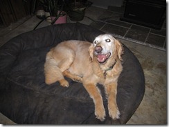
Mattie Ann - a gentle soul!(Mattie Anne – a gentle soul has left us leaving a void in our home.)

Until later,

- Zeke

Wednesday, July 28, 2010

RIDING THE ROUTE

I managed to catch some sunshine and no sign of a thunderstorm on the horizon at 5:00 p.m. on Tuesday, July 27th as I was finishing up work. Weatherunderground verified my local observations. Nothing in the way of a thunderstorm or shower was popping in Western North Carolina. The nearest rain was in east Tennessee some 2 hours away. IT’S RIDING TIME!

My plans have been to ride parts or all of the Blue Ridge Breakaway metric century route. Tuesday seemed like a good day to catch parts of it. I left out of my office skirting around as much of the end-of-workday traffic as I could and cruised on down NC 209 where my plan was to jump onto Iron Duff Road at the intersection of Coleman Mountain Rd. and Iron Duff Rd. Known locally as the triangle, this was my jumping on point for part of the BBR route, which I have since discovered goes by the name Trout. Hawk, I believe, is the name given to the century ride.

I was about .5 miles into Iron Duff Road and some 7 miles from my office when the first drops of rain began to fall. Ah, a cooling light mist I said to myself! Enjoy. After all, the day is hot and you’ve worked up a sweat getting here.

As I was making the slight uphill climb before dropping down to the river basin, the cool mist was reviving me and reducing the muggy feeling in the air. Another mile down the road, the slightly heavier mist was beginning to resemble something called rain and my glasses were getting wet on both the inside and outside of the lens making vision difficult. Finally, as I slowly descended through the last left hand turn before crossing the Pigeon, I could feel the rain running down my back and my chest and legs were, of course, soaked.

I made the right hand turn onto Riverside and began my trek up river toward Crabtree Church Road. The rain had become quite heavy at this point and I began to worry that my unprotected cell phone and camera might get ruined by the merciless downpour that was now assaulting me. Well, O.K., it wasn’t quite that bad but I was soaked. When I saw the small minnow come flying out of my right shoe, I knew that I was thoroughly soaked. My feet were squishing out water with each turn of the crank only to be replaced by new rain running down my legs and getting filtered through my socks where the never ending loop of water-in, water-out was taking place.

I was basically riding blind by that point because I had nothing dry left with which to wipe my glasses. The few oncoming vehicles added to the rain pelting me as they threw up spray as they passed me by. Surely, that wasn’t a big grin on their faces as they rode on down the river. For 3 miles, the rain was my companion. Gosh, I was having fun!

The rain began to abate and sure enough the blue skies returned looking crisp and clean. The musky smells of the local agricultural lands and freshly mown grass rose up to meet me as I climbed Crabtree Church Road, the second climb of the Trout route. I took a short break at the United Methodist Church at the intersection of Crabtree Church Rd. and NC 209, which will be the site of the first big water stop on the BBR. I needed to clean off my glasses, check my phone for working order, and call the Navigator to report my whereabouts. It turned out she had called me during the little rain event as I now refer to it but I didn’t hear the phone ring.

After giving a short progress report and assuring her I was fine, I returned to the Trout route and made my way to Big Branch Rd., precursor to the climb over Hyder Mountain. I had not ridden up this side of Hyder Mountain. I knew it to be a longer climb than from the Clyde side but not near as steep. I was eager to see what it was like.

Big Branch Road Lead-in(Big Branch Road after the rain passed) 

The climb started out with a mild grade and surprisingly stayed that way. I was able to stay on my middle ring for the full ascent of the mountain. This is a very picturesque part of Haywood County with family farms lining the roads and the mountains in the background.

Family Farm on Big Branch(A family farm along Big Branch, part of the BBR ride)

After topping Hyder Mountain, it was a swift descent on the steep side of the mountain back down to river level. I took my normal route toward Clyde, NC on Hyder Mountain Road. This section down to Clyde is also part of the BBR ride. At this point, I was about 18 miles into my ride and feeling good so I decided to take the longer Thickety Road path to Canton on my commute home.

As I approached the last steep climb on Thickety Road, I was still feeling pretty good although, by this point, I could tell my legs were tiring. I was drinking and eating my Power bars on a regular schedule because I knew I still had approximately 17 miles to get home. Traffic was light and the air temps remained cooler than before the rain. Getting to Canton occurred without incident until I had to stop at a traffic light at Fiberville Rd.

When I tried to start up, my left calf went into a full fledged cramp and I couldn’t get clipped in. I was scooting, hobbling, semi-gliding my way through the intersection so I could get to the curb and work out the cramp. I feel certain that the onlookers in the intersection wondered what kind of new riding style they were seeing! I managed to get moving again and was alright except for a notable tug in my calf. It seemed that as long as I could spin the crank, I wasn’t going to cramp again.

Finally, I made it through Canton and past the Recreation Park. I was riding up river along NC 215 to Bethel trying to get home. I called the Navigator and politely encouraged her to come down the mountain and pick me up at Bethel Grocery Store. By the 34th mile, I felt like I was spinning about 20 revolutions and having to stop and coast. If the goal of a workout is to achieve a burning sensation, I was having one heckuva great workout! I recall Bob Roll talking about the pros being popped when they started pedaling squares. Heck, I was pedaling polygons at this point!

All good things must come to an end though and the Navigator was patiently waiting for me as I completed my 35 mile trek home. It felt good to get the mileage in and to preview part of the Trout route. It also sure felt good to get in the car with a little wider butt support and then it REALLY felt GOOD to get in the shower!  Next up, will be doing the Stamey Cove climb, which is clearly the steepest more difficult climb of the Trout route. We get to enjoy both sides of that climb coming and going on the Trout route. I’ll hopefully get that in this weekend sometime. Tomorrow, I’ll be helping lead our new riders group in town and that will be at a slow leisurely pace.

BRO DAVE SHARES HIS NEW FARGO

Bro Dave is enjoying his new Salsa Fargo out on the west coast. He is giving quite positive reviews to his 29’er and has managed to get in a few rides in between work and being the up and coming new COACH OF THE YEAR in his daughter’s Rec League basketball conference/district/group (not sure what to call it…).

DavidsFargo01

DavidsFargo02


He sent along a couple of shots overlooking the Encino Reservoir and the San Fernando Valley. Here’s hoping he’ll be proudly hoisting a championship banner on the back of the Fargo! Go Coach Bro Dave!

Until later,

- Zeke

Tuesday, July 27, 2010

AARP PROMOTES CYCLING

The  Association of American Retired Persons (AARP) featured an article on cycling in the July – August 2010 Bulletin. The article titled Biketopia covers the increase in American cyclists and how one town, Brunswick, Maine, has increased their cycling infrastructure resulting in an increase in ridership. There are also 5 helpful hints on how any community can become bike-friendly. Author Rob Gurwitt connects with numerous over 50 years old cyclists involved in the cycling culture around Brunswick. He reports that years ago Brunswick “made  a commitment that every middle-school-aged child should be able to bike safely anywhere in their town.” Episcopal priest John Balicki, 60, former Maine Department of Transportation bike/ped coordinator says “we're not there yet. That’s our next frontier.” It is refreshing and affirming to see that the elders of our generation are taking cycling to heart. It also shows the breadth of the cycling movement in America, i.e., you don’t have to be spandex clad roadie or a MTB flash to enjoy cycling! (Not that there’s anything wrong with it….)

For the on-line version and to see a well done video on the Brunswick bike path, visit Biketopia.

BLUE RIDGE BREAKAWAY

This past Saturday I had the opportunity to drive with Ken Howle, one of the coordinators for the inaugural Blue Ridge Breakaway, around the metric century route of the upcoming BRB. We were using multiple gadgets to get altitudes and mileage measurements for the route. It also gave me a chance to preview the route from the comfort of air conditioning!

We used a SPOT II, a Garmin Oregon 400T, and Ken’s Smartphone using an included maps program. The course had previously been mapped on MapMyRide by the event organizers. Our goal was to compare and contrast any differences we found. Well, to no one’s surprise, we did get differences in both mileage and altitude gain. The MapMyRide result had substantially longer mileage and greater elevation climb than any of the other programs. The SPOT II turned out not be very helpful because the points were “as the crow flies” and did not take into account the road’s twists and turns, which, of course, adds mileage. Our handwritten notes transferred to a spreadsheet matched up best with the Smartphone app used by Ken. We were relatively close in both mileage and elevation gain. We also made liberal use of Google Earth in post drive editing.

Regardless of which instruments was used, I can tell you that the organizers have laid out a very challenging route for both the century and the metric century routes. The metric century and century routes start at the open air gymnasium at Lake Junaluska Methodist Assembly and proceed west on US 19/276 before heading north on US 276. A right hand turn on to Coleman Mountain Road will feature the first climb of the day. Rides will peak out at 2870’ elevation before taking a winding descent to Iron Duff Road.

Turning left on Iron Duff, riders will have a descent to the Pigeon River (elevation 2463’) where the century riders will turn northwest toward Panther Creek and the metric century riders will turn east along Riverside Road. The century riders will proceed along 2 more climbs before getting to Fines Creek and a turn back southeast onto NC 209 and a long climb up the backside of Rush Fork Mountain. Metric Century riders will ride along the river to Crabtree Church Road and a climb up to NC 209 where the first water stop of the day occurs and the two rides rejoin.

Following a short pedal to Golf Course Rd. and Big Branch, both groups will then climb the Crabtree side of Hyder Mountain, which peaks at 2827’ after a climb up from 2492’ at the beginning of Big Branch. This side of the mountain is a longer climb but substantially lower grade than climbing up from the Clyde side of Hyder Mountain.

After descending Hyder Mountain, the riders will make their way to Clyde, NC along Hyder Mountain Road and then cross over Main St. and Carolina Ave. in Clyde. The next climb of the day is Stamey Cove Road with a peak elevation of 3040’ after a steep ascent featuring hairpin turns. This is part of the old Bele Cher race route from years ago although that route went in the opposite direction. From the peak, riders drop down to the Pigeon River again just above the town of Canton and make their way along NC 209 to Wells Road, which connects NC 209 and NC 110.

The second water stop of the day is planned for near this location. Riders will continue on south on NC 110 to the intersection of US 276/NC 110. The route crosses over to one of my favorite rides in the area and one I’ve written about many times – Love Joy Road. At the intersection of Love Joy and Lake Logan Road riders will make their way south toward Lake Logan and the Blue Ridge Parkway. Another moderate climb will greet the riders as they spin their way to the top of the ridge above the lake. At the bridge crossing the upper end of Lake Logan, a 3rd water stop is planned.

At this juncture, the century riders will continue on NC 215 (Lake Logan Rd) to the Blue Ridge Parkway. This is a long climb of another 10 miles or so. The grade picks up above Sunburst Campground and remains around 5% or so to about 2 miles below the BRP. The grade really jumps up the final mile before reaching the BRP at 5340’ elevation.

Century riders will turn south on the BRP and then climb to the highest point of the Blue Ridge Parkway at Balsam-Richland (6052’ elevation) before dropping down to Balsam Gap (3340’ elevation) and then climbing another 7 miles to the top of Water Rock Knob (5722’ elevation). Following a descent to Soco Gap (4340’ elevation), riders will turn east on US 19 and return to Lake Junaluska Assembly.

Metric century riders will use the Lake Logan water stop as their turn around point and will retrace their way to Clyde including another climb over Stamey Cove before dropping back into Clyde. A slight change in route will include a return to Lake Junaluska and the assembly grounds via Old Clyde Road and then along South Lake Shore Drive before a very short segment along US 19. All riders return to the open air gym for the finish.

I was tired just thinking about these courses. It should be a great day of riding in beautiful Haywood County. Come for a visit and join us as we thrill in the climbs and descents of our very old, very beautiful mountains! To register and get more details, visit Blue Ridge Breakaway.

LOCAL WEATHER IS TEMPETUOUS…

… and irritatingly timed! Our area has been visited by strong thunderstorms and heavy rains the last week. Unfortunately, they fire up just about “riding time”, which is the end of the work day for many of us. Last week’s BicycleHaywoodNC new riders group had to be cancelled due to inclement weather and my own ride yesterday was stopped due to thunderstorms. Today’s forecast looks worse than yesterdays. I need some miles under me so I can survive the Blue Ridge Breakaway. Maybe today – but probably not…

Until later,

- Zeke

Wednesday, September 2, 2009

TWO WEEKS – TWO GOALS ACHIEVED!

I mentioned in my last post that I felt that I had ascended from a plateau where I’ve felt stuck the early part of the summer. I just didn’t feel that I was progressing in my stamina or climbing skills until the past 3 or 4 weeks. I was struggling to get up climbs that I thought I should have mastered already. Well, I’m pleased to say that I’ve bitten off two of my goals within the past two weeks.

Last week, I finally managed to top the first climb leading to Rush Fork Gap. I had the distinct feeling that my heart was going to burst and save someone the trouble of spreading my ashes. My heart rate was popping along at 183 bpm when I finally topped the climb. My top heart rate should be 165 bpm for my age group. (Note to cardiologist: I’m probably not going to have a heart attack.)

RushFrk_DidMake

(Photo – my own. Three quarters way to top of first Rush Fork Climb)

The “Wood-man” has been telling me that part of my problem with this climb was psychological and that I just needed to get out there and “git er done.” I think there was truth to his statement. I had tried and failed 3 times previously to make it up this first incline. I would start dreading the attempt long before I managed to get to the beginning of the climb. I was determined this time that I was going to make it. I was riding with “Cross Country Stan” that day so I just latched on to his rear wheel and followed him up the climb. I think he must have experienced a tailwind of sorts as I felt like I was breathing so hard near the top, I must have been pushing him ahead! At any rate, one goal down – more to come!

RushFk_1st(Photo courtesy “Cross Country Stan” at top of first Rush Fork Climb)

Our Tuesday ride this week kept dwindling down in numbers until I thought I would be riding by myself. Fortunately, “Big Ben” pulled in just as I was starting to clip in and head out for a solo run. “BB” normally rides with the Thursday evening power group so this was my first opportunity to ride with him. “BB” is a member of our local advisory council and has spent many years on a bike. He is quite a bit younger than me and MANY pounds lighter so I was looking forward to this opportunity to ride. Along with interests in cycling, we also share career interests as well. Although, I’m at the end of my career and he is near the beginning of his. Still, it is enjoyable to be in his company.

We headed out along the local greenway and made our way to NC 209, which if you read this blog more than once, you’ll discover is becoming sort of a backbone of rides for me. The northern end of the county offers some fine two lane, low traffic count rural byways that traverse some beautiful agricultural areas in Haywood County. Our start time was 5:15 p.m. just after work and there was definitely a touch of early fall weather. The air temps were down and the air felt crisp for the first time. Alan, over on Eco-Velo, commented in his August 28th posting “Another beautiful sunrise this morning. Fall is coming…” It seems like only last week he was commenting about the gorgeous sunrise where he lives and that “spring was coming…” This summer has seemingly slipped away at a faster pace than preceding summers. I know that we circle the big light in the sky at the same pace as we did when I was a child but, my experience of those same 365 days just seems to be getting faster and faster as I start my own personal journey toward winding down my time on this globe.

From NC 209, “Big Ben” and I jumped over to Iron Duff Road and followed Coleman Mountain Road on its winding course over the mountain. Riding alongside “BB”, I managed to meet my second summer goal, which was to get past Jack Pine Dr. and spin my way to the top of the mountain. I’ve typically stopped at Jack Pine, which is about halfway up the mountain on the eastern side and caught my breath and let my heart rate return to something approaching normalcy. There is a nice view there so it hasn’t been punishment to pull of. In fact, I’ve taken the opportunity to grab a picture there in the past.

Ride040809 001

(Photo – my own: Image taken from Jack Pine Dr.) 

This day, though I pedaled on by Jack Pine and crested the top of the mountain looking down on I-40. From the top of Coleman (35.34.52 N, 82.59.11 W, elevation 2936’), it is a nice long descent almost all the way to the intersection of Coleman Mountain Rd. and US 276. A nice long stretch starts the descent and leads into a slight left hand curve as you pass under I-40 before enjoying another short straight stretch. This segment runs into a series of “S” curves that are tighter and require that you pay close attention to the road. Of course, you only need to do that if you aren’t worried about becoming a hood ornament on an oncoming farm truck or finding a need to avoid plugging yourself into a slow moving tractor from behind as you round the curves. This is, after all, farm country!

Making a southerly turn onto US 276 leads riders onto a well maintained split 4 lane highway that runs the length of Jonathan Valley. By this time of the evening, the sun is casting long waves of light across the valley and the whole valley is encompassed in golden, warm light. In his book Serena, author Ron Rash’s character Rachel Harmon comments as to how the mountains sinking into the shadows of night provide her with a comforting and sheltering feeling. Riding up this peaceful valley, it is easy to adopt her viewpoint.

image

The image above shows Coleman Mountain Road descending to US 276 (35.35.30N, 83.00.31 W, elevation 2515). You can then see the lower end of Jonathan Valley in the image. Largely a farm community, this section of Haywood County is under threat of being developed into a Pigeon Forge, TN like shopping district. The likelihood of this ever occurring is questionable but, the topic does keep raising its ugly head periodically.  It doesn’t take much to get a strong debate going over individual property rights and wise use of the remaining land. But, that is a topic for another day and another forum. On this particular day, the valley was the location of an excellent sunset ride in some excellent farming areas.

After intersecting with US 19, “BB” and I made our way back east in heavier traffic before turning south toward Waynesville and Russ Avenue. The final climb of the day starts at a traffic light at the intersection of Mauney Cove Rd. and US 276. This is a well paved 4 lane road that continues on to the “fast food – neon lights” northern end of Waynesville. In short time, we were back at our originating point and wrapping up the ride. 

So, two weeks – two goals achieved… Time to set some new goals for the fall riding season but mostly it is time to simply enjoy the pleasures of being outdoors with friends as we fly along the countryside…

Until later,

- Zeke