Showing posts with label NC209. Show all posts

Monday, September 16, 2013

GREETINGS FROM THE LOW COUNTRY!

The Navigator, Wood-Man, Sherry Shazam , and I are making what has become our annual Rest, Ride, and Recharge (RR&R) trip to Hilton Head Island in the Low Country of South Carolina. A League of American Bicyclists 2011 Silver award winner, HHI provides lots of opportunities to get out and about on two wheels.

Spencer Beach approach

(Approaching Spencer Beach, a private community on HHI)

The Wood-Man and I had a nice 16 mile cruise yesterday to shake out the legs and make room for some grilled steaks purchased at the Fresh Market here on the island. I suppose I should have made that Rest, Ride, Recharge, and Eat (RRR&E).

Monday, June 6, 2011

THOSE STORIES THAT HAPPEN TO OTHERS

You’ve read them, you’ve seen them, you’ve maybe even experienced them. The stories that deal with the dominoes affect when problems occur. Sometimes folks will say bad things happen in 3’s. Well, Sunday was my day in the fun barrel…

Monday, February 21, 2011

SIGNS OF THE PENDING SPRING SEASON

The unseasonably warm weather that has graciously been visiting the mountains of Western North Carolina has continued into the early part of the work week. I’ve been lucky enough to get in some road riding with both a small group and solo the last couple of days. While out and about, I’ve noted the early signs of the emerging spring season.

Of course, there are those that we all recognize such as the earliest bloomers making themselves known and the return of certain birds. Its about this time of year that the blue bird does his scouting for nests.

bluebird_red_crested

(This hearty fellow will soon be looking for a house…)

It is often hard to tell which birds are the harbingers of spring anymore as we seem to have more birds wintering over than happened in my youth. So, we must look to the tried and true signs of spring to know that the season is nearly upon us. One such sign is this…

Sunday, November 28, 2010

…AND HARRY MAKES THREE!

By yesterday (Saturday, November 27th), my post-Turkey haze had lifted enough and holiday/home chore duties had been cleared enough to make some time for a ride. Heaven knows I needed it!  The Wood-man and I determined on Friday night that we would get out and put a few miles into our legs this weekend…

Tuesday, November 9, 2010

FALL WEATHER MAKES GLORIOUS RETURN!

The touch of winter last weekend that resulted n 7” of snow in places and only short lived traces in other places has been replaced by some gorgeous, glorious, sumptuous riding weather. The end of Daylight Savings means that after work rides are a thing of the past for several months. The silver lining to that cloud is that lunch rides are just simply wonderful! The temps are up and pleasant and this day there wasn’t a cloud in the sky…

Looking east from Crabtree Church Road(A clear sky to the east from Crabtree Church Road…)


Tuesday, October 26, 2010

THE DOGS OF MADISON COUNTY AND OTHER MATTERS!

(Part II)

This is part II of two parts covering Zeke and the Wood-man’s ride on Saturday, October 23, 2010 from Waynesville, NC to Newport, TN.

To read Part I, CLICK HERE!


In Part I, the Wood-man and I had just competed our 20th mile of the trip and were sitting nicely amidst the colors of Betsy’s Gap. We were ready to mount up and head down…

Monday, October 25, 2010

2 States, 3 Dogs, 21 Miles of Climbing & 1 WWII Veteran

(Part I)

Well, the ride that the Wood-man and I undertook Saturday is hereafter named The Wood-man’s Betsy’s Gap Invitational”  and should probably happen annually from this time forward. As the only invitee to this year’s effort, I was pleased to accompany the Wood-man on a 65 mile jaunt…

Friday, October 8, 2010

THAT THING ABOUT THE LAW OF AVERAGES…

After several days of coolish weather that in 3 months we’ll be calling a heat wave, yesterday turned out to be an immaculate day. My juices for riding were flowing. My work duties were sufficiently under control for a change allowing me to beat the end-of-work traffic to the roads. I made arrangements with the Navigator to pick up my clothing and laptop at my office and I hit the road.

An omen was about to present itself for my consideration…

Thursday, September 16, 2010

A RETURN TO THE S.C. LOW COUNTRY!

After what felt like days and days of getting ready for a short mini-vacation, the Navigator and I have arrived on Hilton Head Island for a few days of R&R as the summer season winds down. We’ve returned in the company of the Wood-Man and Sherri Shazam – the Navigator’s sister. We made a similar trip last year and enjoyed the infrastructure for cycling activities. From what I’ve seen so far, the cycling activities have certainly not diminished. I’ve already spotted 3 separate bike shops and lots of folks out cycling on the separated bike paths. Of interest, are all the stops signs warning cyclists and pedestrians alike that cars have the right of way. It makes for a lot of stop and go riding.

Before we arrived here…

Back home, the first tendrils of fall’s outreach were making themselves known. The skies have been incredibly clear and the overnight temps reaching into the upper 40’s making for some fine sleeping weather. Day time temperatures are still reaching the low 80’s and my evening commute home was outstanding.

This past Monday evening, I left the locale of my new office, which is within a stones throw of my old office,  and headed home via NC 209 as is my usual. However, this time, I extended the ride down NC 209 crossing over I-40 and turned back onto Big Branch in order to climb the backside of Hyder Mountain.
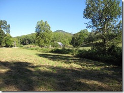
Big Branch looking toward Chambers Mtn (Big Branch looking toward Chambers Mountain)

As the ride home progressed, Chambers Mountain was always to my left and prominent in the landscape. Chambers is easily identifiable because it has become the home of seemingly every known radio tower in Haywood County. Its towers often gleam silver in both the rising and setting suns. On this particular ride, I was surprised that I had nearly ridden all the way around the base of the mountain having been on its western, southern, and eastern sides.

At the top of Hyder Mountain, sits Fincher’s Chapel. Its steeple prominent on top of the highest point of this climb. It is especially noticeable from the Clyde side approach as that is the steepest approach to the gap and the church sits right beside the gap.

View of the Balsams(View of the Balsams along the Blue Ridge Parkway from Fincher Chapel) 

This image taken from the gap doesn’t do justice of the 12% gradient approach to the gap. The descent to the base of Hyder Mountain is fast with a couple of sharp curves requiring close attention. The penalty for enjoying the scenery too much on the way down is a trip through barbed wire and perhaps “sleeping with the goats” instead of the better known “sleeping with the fishies” from crime novels.

“The ribbons of my ride”…

From this point, I was back on my usual trip home that I’ve written about many times. However, on this particular day, in addition to being cognizant of the prominence of Chambers Mountain, I also found myself contemplating “ribbons.” No, not the pink, yellow, red, green, multi-colored ribbons used to signify various charitable causes but, rather, the metaphorical ribbons that accompanied me as I made my way home.

I’m speaking of two “ribbons” in specific: Interstate 40 and the Pigeon River. Both are ribbons of sort and would appear as such from views from outer space. Both wind their ways through Haywood County and both have had tremendous impact on the commerce and qualities of life of the citizens bordering their “flow” through our community. Unquestionably, both have provided financial rewards by providing long term income to generations of Haywood County citizens. Of course, both have their detractors as well. The Pigeon, once almost a “dead” river due to paper mill discharges, has been blamed for high cancer rates downstream in neighboring Tennessee.

But, I digress… On this day at this time, I found myself focusing on how each ribbon accompanies me on significant portions of my commute home. I-40 is a constant presence by way of noise generated by passing vehicles as I first cross over it at the intersection with US 209, run alongside it as I make my way to Clyde, run under it on the leg to Canton, and then finally cross over it again as I approach Canton. The Pigeon River actually accompanies me for almost all of the ride on this route.

I first pick up the Pigeon as its path leads it around Hyder Mountain but this is a short crossing only just past the intersection of I-40 and NC 209. I leave the river until after the climb of Hyder and pick it up again at the base of Hyder. The river, at this point, well below the paper mill in Canton, is always the color of tea, which is the result of the tannins used in the production of paper and is enhanced by the permanently stain rock below the water. On occasion, a stench still assaults the nose as I pedal toward Clyde and Canton. I often refer to the stench as “smelling the money” to somehow minimize the noxious affect of paper production.

A short section of my route takes me away from the river briefly but I’m soon reunited with it in Canton at the paper mill. As I circumnavigate the mill, I come back alongside the Pigeon above the mill. The water is clear and fresh at this point before it gives itself up to the rinsing of wood pulp as paper is made. The final 5 to 8 miles of my commute is fully alongside the ribbon known as the Pigeon River. I’ve been blessed to see see it throughout all the seasons, before and after flood stages, and at times of local drought. As I approach the end of this night’s ride, I find myself grateful for the “ribbons” in my life…

“If I can walk it, I can climb it” revisited…

In my recent post, I posited the thought that “if I could walk it, I could climb it” as being important in my evolution as a cyclist. In that post, I indicated I had only tested this hypothesis on a maximum of a 12% grade. Well, I decided I had better continue to test my theory for accuracy.

To do so, I’ve now concluded my last couple of rides by riding from the base of our road up the mountain to the house. In the past, I’ve relied on the Navigator to pick me up and save me or, more accurately, my legs the trouble of climbing our road. This is not a good road by anyone’s estimation. A former wagon track, the road services  3 homes and the fortunately UNDEVELOPED mountain above us. We do what we can to keep it passable by our vehicles. Keeping it in road bike shape has not been anyone’s idea of good way to spend money.

The road is unequal parts of old pavement, river rock, gravel, leaves, dirt, and more than one or two holes. As it turns out it is also a grade of 15%. I can now report that despite a spinning rear wheel costing me momentum, “if I can walk it, I can climb it” remains true. Fortunately, the 15% grade is only .2 of a mile to our drive. So, staying with the theme of “ribbons in my life”, this particular “ribbon of broken road” has helped me continue to evolve and build my climbing muscles. When I crest the drive to our home, that deck sure does look inviting!

Back to the Low Country…

This brings me to the end of today’s epistle as the Wood-Man just called it. We’re heading out to get some protein before we ride!

Zeke dockside in the Low Country(The Navigator catches Zeke writing dock side on Hilton Head) 

Hey, it’s a dirty job but somebody’s got to do it!

More later from the Low Country!

-Zeke

Monday, August 23, 2010

BLUE RIDGE BREAKAWAY REVIEW, PART II


Part one of the ride of the inaugural Blue Ridge Breakaway.


When last I left you, Wolfpen Andy and I had just enjoyed a nice long train ride behind a tandem and 3 cyclists and were making the right hand turn onto Coleman Mountain Road and the first moderate climb of the day for all routes of the Blue Ridge Breakaway

After crossing Jonathan Creek on Coleman Mountain, we were still riding along behind the “train” and beginning the very early rise of the climb to the peak above I-40. I was still on last wheel and then, I wasn’t… The tandem and accompanying cyclists, including Wolfpen Andy, were still motoring on up the mountain at a pace I knew I wouldn’t survive and get to the top. I quickly dropped back into my Kent “Mountain Turtle” Peterson personae and began to “hasten slowly”. 

Coleman Mountain has a couple of small inclines and dips before the main part of the climb begins and you cross under I-40 before making a right hand turn to a straight stretch leading to the top. Wolfpen Andy had dropped from the “train’s” wheels and we rejoined just as we went under I-40. I saw my first cyclist of the day on the side at that point. This person had popped just before the underpass, which is about 1/3rd of the way up the climb.

As we made our way to the top, some distance had opened between myself and Wolfpen Andy and I decided to go ahead and begin the winding descent to Iron Duff Road intending that we would hook up again at that point. The top of Coleman on the Iron Duff side has about 5 curves in the top half and is rather serpentine around the point where Jack Pine Drive joins to Coleman Mountain. I had good speed going down and did not have to avoid other cyclists as there were none in front of me. The tandem train was long gone and I was not to see them again.

I was enjoying the descent but got just a wee bit hot into one corner and my heart jumped up into my throat as I tried not to panic and trust the bike. All worked out well and I finished the descent with good speed. At the intersection of Coleman Mountain and Iron Duff Road, I checked for Wolfpen Andy but he was no where to be found.

(Note: In a phone call Saturday evening, Wolfpen Andy told me was descending Coleman behind me when a cyclist blew past him and was way too hot for the curve at Jack Pine. He lost control and went off the road into the bank and assorted bushes, vines, and trees. Wolfpen Andy stopped to check on him and help him to the side of the road. He stayed with him until the motorcycle support arrived before he resumed his ride of the 40 miler.

My best friends live on Jack Pine and I was telling them about the accident at their drive. Nick said he was glad that the cyclist wasn’t hurt seriously but that he’d have to wait for 2 to 3 days to see all of the outcome of that crash. Being familiar with the specific bank and location, Nick advised that it was full of poison oak! Our fallen comrade may be itching up a storm by the time you read this!)


Betwixt and Between seemed to become my theme for the remainder of the ride from this juncture. I rode the full descent to the Pigeon River and the right hand turn onto Riverside alone having no cyclists behind nor in front of me. It was pretty much a solo adventure for the rest of the day. I made my way up Riverside and enjoyed the smells of barbecue being cooked along the way and then made my way up Crabtree Church Road before coming upon a lone cyclist making his way to the top. Just before the peak of the short climb, we were greeted by fans 3 deep along the side of the road cheering us on. Well, actually, it was a father and his two daughters and he was standing behind the two of them. Still, they did cheer us on!

Crabtree Church Rd. intersects with NC 209 and the first water stop of the day was immediately on our right at Crabtree United Methodist Church. All routes of the ride were to come by this position so it was a large stop manned by many volunteers. Everyone was greeted warmly and volunteers offered to hold bikes while the participants refreshed themselves with food, drink, and visits to the portajohns.

Zeke's Fuji CCR3 in good hands!


(Friendly volunteer watching over my bike!)

Crabtree FUMC water stop


(The first aid station of the day laid out with goodies!)

The first of the Century riders had not made it to this point as I departed but we were  soon joined by the young man on his 18” bike referenced in part one of this story. He was still going strong! I’m not sure he had worked up a sweat at this point.

After a short break and refresher, it was back to the course. I followed out two cyclists, who were unfamiliar with the course. As we pedaled along NC 209 to Golf Course Road and then Big Branch, I gave them a short introduction to the remainder of the 60 mile route. In short order, we were climbing up the backside of Hyder Mountain Road and I found myself again riding solo. I recall a nice greeting from a resident as he was putting out his American flag on his second floor deck. Topping Hyder Mountain was a moderate climb leading to a steep downhill descent and the Pigeon River. It was at this point, the 40 milers and 25 milers would return to Lake Junaluska. The century riders and metric century participants turned east on Hyder Mountain Road and spun along the riverbanks of the Pigeon to Clyde, NC where the second aid station of the day was located.

It was at this point that I found out about what appeared to initially be a serious accident. Riders were required to stop at all traffic signs/lights and this location was a major intersection of travel from Waynesville to Canton. A rider had stopped at the traffic light in order to cross over Carolina Boulevard and begin the approach to Stamey Cove. It is unclear to me exactly what happened at the traffic light but the most common report that I’ve received is that a truck pulling a horse trailer pulled up on the left of the cyclist. When the light changed, the truck proceeded to turn right in front of the cyclist and shortened the turn dragging the horse trailer across the curbing and pulling the cyclist under the trailer.

It is not clear at this point why the truck driver proceeded as he did and I do not know whether he was charged with any traffic offense. The good news is that the rider was transported to the hospital and treated for abrasions and other non-life threatening injuries. He was later released and was reported to be home and doing well on Sunday.

The next section of the ride was the most difficult climb for the metric century riders. Well, to be more accurate, it was 50% of the most difficult climb because the planners of the route had us climbing Stamey Cove on the outgoing leg and on the return leg. The two sides are both difficult although their characteristics are different. Along this short stretch before the climb began, I enjoyed a brief conversation with a cyclist, who was riding in support of her friend. The friend was struggling mightily at this point and we had not yet arrived at the climb. We soon parted ways and I made my way up the initial steep climb. On the Clyde side of Stamey Cove, you have an initial steep climb into a left hand hairpin turn and then a LONG steady climb to the top.

I was just short of approaching the hairpin curve when I heard “on your left” for the first time in quite awhile. It turned out to be the lead pack of century riders. I was “hastening slowly” up the mountain and they passed me like I was standing still, which wasn’t far from the truth. It was a humbling experience to be passed so easily on such a steep climb. They were gone and out of sight rather quickly leaving me to my solo ascent of the climb free to wonder if I could have ridden at that pace in my 20’s.

The gap was in sight and I was again greeted by a local resident, who was leaning over the deck of her railing and appeared to be enjoying the morning. I inquired as to her state of being and she inquired as to mine. We both agreed she probably felt better than I did at that moment! The gap was soon under my wheels and I was shifting to the big ring looking for some speed downhill.

The descent to the Pigeon River was swift and fun and my legs were able to recover nicely. A short run up NC 215 and then across Wells Road soon brought me to NC 110 about one half mile short of the third aid station. At this point, we had run along and over the Pigeon River at least 3 times since beginning the route. Soon enough I pulled into the local Church of God parking lot and the aid station where the Navigator was working.

Zeke and the Navigator(Getting my 24 mile (or so) hug from the Navigator) 

A local Girl Scout troop(?) was greeting riders at the entrance to this aid station with signs and lots of energy. The aid station was slightly below road grade and difficult to see without the presence of the Scouts. The Navigator told me later that a gentleman of Hispanic heritage saw the girls and thought it was a car wash. He pulled in and was trying to inquire about getting his car washed. Unfortunately, his English was worse than the Navigator’s Spanish. I’m sure it was an interesting attempt at conversation before he finally figured out he wasn’t getting his car washed!

After a short break and pick up of my water bottles from the Navigator, I was back on the route and headed to the aid station at Lake Logan, which was the turn around point for the metric century riders. It was along this next section after the Church of God aid station that I would begin to see the first of the returning metric century riders leaving me to ponder my relative position among riders on the metric century ride.

I was lucky to catch the rear wheel of 3 riders doing the century route and benefitted from their pull the rest of the way to the NC 110 and US 276 intersection and the beginning of Love Joy Road. As we started a short climb, I knew my time with them was over and said my good-byes and thanked them for the pull…

(In part 3 of my report, I’ll cover the return trip to Lake Junaluska, the most serious crash of the day, a dramatic change in weather, and oh yeah the post race rescue efforts that were made…)

Until later,

- Zeke

Wednesday, July 28, 2010

RIDING THE ROUTE

I managed to catch some sunshine and no sign of a thunderstorm on the horizon at 5:00 p.m. on Tuesday, July 27th as I was finishing up work. Weatherunderground verified my local observations. Nothing in the way of a thunderstorm or shower was popping in Western North Carolina. The nearest rain was in east Tennessee some 2 hours away. IT’S RIDING TIME!

My plans have been to ride parts or all of the Blue Ridge Breakaway metric century route. Tuesday seemed like a good day to catch parts of it. I left out of my office skirting around as much of the end-of-workday traffic as I could and cruised on down NC 209 where my plan was to jump onto Iron Duff Road at the intersection of Coleman Mountain Rd. and Iron Duff Rd. Known locally as the triangle, this was my jumping on point for part of the BBR route, which I have since discovered goes by the name Trout. Hawk, I believe, is the name given to the century ride.

I was about .5 miles into Iron Duff Road and some 7 miles from my office when the first drops of rain began to fall. Ah, a cooling light mist I said to myself! Enjoy. After all, the day is hot and you’ve worked up a sweat getting here.

As I was making the slight uphill climb before dropping down to the river basin, the cool mist was reviving me and reducing the muggy feeling in the air. Another mile down the road, the slightly heavier mist was beginning to resemble something called rain and my glasses were getting wet on both the inside and outside of the lens making vision difficult. Finally, as I slowly descended through the last left hand turn before crossing the Pigeon, I could feel the rain running down my back and my chest and legs were, of course, soaked.

I made the right hand turn onto Riverside and began my trek up river toward Crabtree Church Road. The rain had become quite heavy at this point and I began to worry that my unprotected cell phone and camera might get ruined by the merciless downpour that was now assaulting me. Well, O.K., it wasn’t quite that bad but I was soaked. When I saw the small minnow come flying out of my right shoe, I knew that I was thoroughly soaked. My feet were squishing out water with each turn of the crank only to be replaced by new rain running down my legs and getting filtered through my socks where the never ending loop of water-in, water-out was taking place.

I was basically riding blind by that point because I had nothing dry left with which to wipe my glasses. The few oncoming vehicles added to the rain pelting me as they threw up spray as they passed me by. Surely, that wasn’t a big grin on their faces as they rode on down the river. For 3 miles, the rain was my companion. Gosh, I was having fun!

The rain began to abate and sure enough the blue skies returned looking crisp and clean. The musky smells of the local agricultural lands and freshly mown grass rose up to meet me as I climbed Crabtree Church Road, the second climb of the Trout route. I took a short break at the United Methodist Church at the intersection of Crabtree Church Rd. and NC 209, which will be the site of the first big water stop on the BBR. I needed to clean off my glasses, check my phone for working order, and call the Navigator to report my whereabouts. It turned out she had called me during the little rain event as I now refer to it but I didn’t hear the phone ring.

After giving a short progress report and assuring her I was fine, I returned to the Trout route and made my way to Big Branch Rd., precursor to the climb over Hyder Mountain. I had not ridden up this side of Hyder Mountain. I knew it to be a longer climb than from the Clyde side but not near as steep. I was eager to see what it was like.

Big Branch Road Lead-in(Big Branch Road after the rain passed) 

The climb started out with a mild grade and surprisingly stayed that way. I was able to stay on my middle ring for the full ascent of the mountain. This is a very picturesque part of Haywood County with family farms lining the roads and the mountains in the background.

Family Farm on Big Branch(A family farm along Big Branch, part of the BBR ride)

After topping Hyder Mountain, it was a swift descent on the steep side of the mountain back down to river level. I took my normal route toward Clyde, NC on Hyder Mountain Road. This section down to Clyde is also part of the BBR ride. At this point, I was about 18 miles into my ride and feeling good so I decided to take the longer Thickety Road path to Canton on my commute home.

As I approached the last steep climb on Thickety Road, I was still feeling pretty good although, by this point, I could tell my legs were tiring. I was drinking and eating my Power bars on a regular schedule because I knew I still had approximately 17 miles to get home. Traffic was light and the air temps remained cooler than before the rain. Getting to Canton occurred without incident until I had to stop at a traffic light at Fiberville Rd.

When I tried to start up, my left calf went into a full fledged cramp and I couldn’t get clipped in. I was scooting, hobbling, semi-gliding my way through the intersection so I could get to the curb and work out the cramp. I feel certain that the onlookers in the intersection wondered what kind of new riding style they were seeing! I managed to get moving again and was alright except for a notable tug in my calf. It seemed that as long as I could spin the crank, I wasn’t going to cramp again.

Finally, I made it through Canton and past the Recreation Park. I was riding up river along NC 215 to Bethel trying to get home. I called the Navigator and politely encouraged her to come down the mountain and pick me up at Bethel Grocery Store. By the 34th mile, I felt like I was spinning about 20 revolutions and having to stop and coast. If the goal of a workout is to achieve a burning sensation, I was having one heckuva great workout! I recall Bob Roll talking about the pros being popped when they started pedaling squares. Heck, I was pedaling polygons at this point!

All good things must come to an end though and the Navigator was patiently waiting for me as I completed my 35 mile trek home. It felt good to get the mileage in and to preview part of the Trout route. It also sure felt good to get in the car with a little wider butt support and then it REALLY felt GOOD to get in the shower!  Next up, will be doing the Stamey Cove climb, which is clearly the steepest more difficult climb of the Trout route. We get to enjoy both sides of that climb coming and going on the Trout route. I’ll hopefully get that in this weekend sometime. Tomorrow, I’ll be helping lead our new riders group in town and that will be at a slow leisurely pace.

BRO DAVE SHARES HIS NEW FARGO

Bro Dave is enjoying his new Salsa Fargo out on the west coast. He is giving quite positive reviews to his 29’er and has managed to get in a few rides in between work and being the up and coming new COACH OF THE YEAR in his daughter’s Rec League basketball conference/district/group (not sure what to call it…).

DavidsFargo01

DavidsFargo02


He sent along a couple of shots overlooking the Encino Reservoir and the San Fernando Valley. Here’s hoping he’ll be proudly hoisting a championship banner on the back of the Fargo! Go Coach Bro Dave!

Until later,

- Zeke

Tuesday, July 27, 2010

AARP PROMOTES CYCLING

The  Association of American Retired Persons (AARP) featured an article on cycling in the July – August 2010 Bulletin. The article titled Biketopia covers the increase in American cyclists and how one town, Brunswick, Maine, has increased their cycling infrastructure resulting in an increase in ridership. There are also 5 helpful hints on how any community can become bike-friendly. Author Rob Gurwitt connects with numerous over 50 years old cyclists involved in the cycling culture around Brunswick. He reports that years ago Brunswick “made  a commitment that every middle-school-aged child should be able to bike safely anywhere in their town.” Episcopal priest John Balicki, 60, former Maine Department of Transportation bike/ped coordinator says “we're not there yet. That’s our next frontier.” It is refreshing and affirming to see that the elders of our generation are taking cycling to heart. It also shows the breadth of the cycling movement in America, i.e., you don’t have to be spandex clad roadie or a MTB flash to enjoy cycling! (Not that there’s anything wrong with it….)

For the on-line version and to see a well done video on the Brunswick bike path, visit Biketopia.

BLUE RIDGE BREAKAWAY

This past Saturday I had the opportunity to drive with Ken Howle, one of the coordinators for the inaugural Blue Ridge Breakaway, around the metric century route of the upcoming BRB. We were using multiple gadgets to get altitudes and mileage measurements for the route. It also gave me a chance to preview the route from the comfort of air conditioning!

We used a SPOT II, a Garmin Oregon 400T, and Ken’s Smartphone using an included maps program. The course had previously been mapped on MapMyRide by the event organizers. Our goal was to compare and contrast any differences we found. Well, to no one’s surprise, we did get differences in both mileage and altitude gain. The MapMyRide result had substantially longer mileage and greater elevation climb than any of the other programs. The SPOT II turned out not be very helpful because the points were “as the crow flies” and did not take into account the road’s twists and turns, which, of course, adds mileage. Our handwritten notes transferred to a spreadsheet matched up best with the Smartphone app used by Ken. We were relatively close in both mileage and elevation gain. We also made liberal use of Google Earth in post drive editing.

Regardless of which instruments was used, I can tell you that the organizers have laid out a very challenging route for both the century and the metric century routes. The metric century and century routes start at the open air gymnasium at Lake Junaluska Methodist Assembly and proceed west on US 19/276 before heading north on US 276. A right hand turn on to Coleman Mountain Road will feature the first climb of the day. Rides will peak out at 2870’ elevation before taking a winding descent to Iron Duff Road.

Turning left on Iron Duff, riders will have a descent to the Pigeon River (elevation 2463’) where the century riders will turn northwest toward Panther Creek and the metric century riders will turn east along Riverside Road. The century riders will proceed along 2 more climbs before getting to Fines Creek and a turn back southeast onto NC 209 and a long climb up the backside of Rush Fork Mountain. Metric Century riders will ride along the river to Crabtree Church Road and a climb up to NC 209 where the first water stop of the day occurs and the two rides rejoin.

Following a short pedal to Golf Course Rd. and Big Branch, both groups will then climb the Crabtree side of Hyder Mountain, which peaks at 2827’ after a climb up from 2492’ at the beginning of Big Branch. This side of the mountain is a longer climb but substantially lower grade than climbing up from the Clyde side of Hyder Mountain.

After descending Hyder Mountain, the riders will make their way to Clyde, NC along Hyder Mountain Road and then cross over Main St. and Carolina Ave. in Clyde. The next climb of the day is Stamey Cove Road with a peak elevation of 3040’ after a steep ascent featuring hairpin turns. This is part of the old Bele Cher race route from years ago although that route went in the opposite direction. From the peak, riders drop down to the Pigeon River again just above the town of Canton and make their way along NC 209 to Wells Road, which connects NC 209 and NC 110.

The second water stop of the day is planned for near this location. Riders will continue on south on NC 110 to the intersection of US 276/NC 110. The route crosses over to one of my favorite rides in the area and one I’ve written about many times – Love Joy Road. At the intersection of Love Joy and Lake Logan Road riders will make their way south toward Lake Logan and the Blue Ridge Parkway. Another moderate climb will greet the riders as they spin their way to the top of the ridge above the lake. At the bridge crossing the upper end of Lake Logan, a 3rd water stop is planned.

At this juncture, the century riders will continue on NC 215 (Lake Logan Rd) to the Blue Ridge Parkway. This is a long climb of another 10 miles or so. The grade picks up above Sunburst Campground and remains around 5% or so to about 2 miles below the BRP. The grade really jumps up the final mile before reaching the BRP at 5340’ elevation.

Century riders will turn south on the BRP and then climb to the highest point of the Blue Ridge Parkway at Balsam-Richland (6052’ elevation) before dropping down to Balsam Gap (3340’ elevation) and then climbing another 7 miles to the top of Water Rock Knob (5722’ elevation). Following a descent to Soco Gap (4340’ elevation), riders will turn east on US 19 and return to Lake Junaluska Assembly.

Metric century riders will use the Lake Logan water stop as their turn around point and will retrace their way to Clyde including another climb over Stamey Cove before dropping back into Clyde. A slight change in route will include a return to Lake Junaluska and the assembly grounds via Old Clyde Road and then along South Lake Shore Drive before a very short segment along US 19. All riders return to the open air gym for the finish.

I was tired just thinking about these courses. It should be a great day of riding in beautiful Haywood County. Come for a visit and join us as we thrill in the climbs and descents of our very old, very beautiful mountains! To register and get more details, visit Blue Ridge Breakaway.

LOCAL WEATHER IS TEMPETUOUS…

… and irritatingly timed! Our area has been visited by strong thunderstorms and heavy rains the last week. Unfortunately, they fire up just about “riding time”, which is the end of the work day for many of us. Last week’s BicycleHaywoodNC new riders group had to be cancelled due to inclement weather and my own ride yesterday was stopped due to thunderstorms. Today’s forecast looks worse than yesterdays. I need some miles under me so I can survive the Blue Ridge Breakaway. Maybe today – but probably not…

Until later,

- Zeke

Thursday, April 15, 2010

A NEW CHARACTER JOINS THE CYCLING CAST!

The summer-like weather continues here in Western North Carolina offering up some fine, fine riding opportunities. Tuesday was another of those warm, bordering on hot, days with nary a cloud in the sky. For my commute home, I’m not sure the weather could have been much better.

Apr13_LoveJoy01(Love Joy Road in the Pigeon Valley) 

Damned if you do, damned if you don’t…

I’m beginning to think that a whole new character must reside along the beginning portions of my evening commute along Business 23/NC 209. This area seems to be where I am most likely to get screamed at, insulted, gestured at, etc. this year. The new character, A$$hole Appleton, must hang with Headwind Harry and Congestion Charlie and have the ability to occupy the brains of random people, who may be nice at other times.

Tuesday’s encounter with A$$hole Appleton occurred at the traffic light on NC 209 and Old Clyde Road. I had passed through the two previous lights on the downhill run past the Lowe’s store and the nasty intersection of Hospital Drive and NC 209. I was actually maintaining the speed limit with zero vehicles behind me. I was cruising until I crossed under the railroad trestle and came upon the traffic light. Of course, it was red in my direction of travel so I had to stop.

As I was duly stopped behaving myself like a good law abiding cyclist should, obeying my responsibilities on the road as a legal form of transportation, a horn starts blowing right on my rear wheel. It seems a red small pickup truck driven by a white haired older man took offense that a) I was stopped at the traffic light or b) I was somehow impeding his ability to not go through the red light. I looked at him and he was doing some pretty good gesturing at me with an angry look on his face. I just raised my arms, somewhat pointing at the red light, but mostly out of frustration at this latest interaction. (No one fingered salute here as I stuck to my goal of not being nasty…)

The light changed and I moved on to the gutter and let the jerk go by. He didn’t bother with eye contact as he went by and he had his window rolled up so a blistering commentary from me wasn’t in the offing. Fortunately, the vast majority of vehicles passing me are driven by folks who either benignly ignore me or are out and out friendly.

Upon reaching Richland Creek Road and making my eastern turn so I could ride along the river, I was pleasantly greeted by at least two drivers as they passed me on the two lane road. This is the road where I recently found a knife and replaced it on the bridge railing. I was eager to see if it was still present. It was…

The remaining portions of the ride were pleasant as I made my way down to Clyde, over to US 23 north to Canton, and then up NC 110 to Bethel. I was still feeling pretty good and most of the negative energy from my earlier interlude was gone. What little negative energy remained was soon exorcised as I enjoyed the lovely evening ride along Love Joy Road.

Apr13_LoveJoy02 (A closer shot of the trees above along Love Joy Rd.)

I can only recall 3 vehicles passing me on this 5 mile stretch as I made my way home. I noted an increase in campers at a small commercial campground on Love Joy. There were a few fishermen plying the waters of the West Fork and I even threw my hand up in greeting to two cyclists as I was beginning my run along Love Joy.

After rejoining NC 215 and heading north, I decided one more climb was in order for the day and I split off on Edwards Cove Road. I determined that a good set of burning quads would finish off the day just right. Edwards Cove has two climbs to overcome and then returns to NC 276 very near the entrance to my home. All in all, a fine day commuting home. I think I even detected Slipstream Sallie accompanying me on Love Joy!

Until later,

Zeke

MapMyRide details:

Thursday, February 19, 2009

Cold Weather, Bum Ankles, And Such...

Well, this week's riding has been limited to enjoying the Tour of California in between late evening appointments. I'm not sure I'll ever complain again about riding conditions after seeing the first couple of days of this year's TOC. Wet and rainy... A tip of the old helmet to all of them. Leipheimer's crossing of Lance's back wheel should be training video somewhere. The TV camera angle certainly presented it well. "Look kids, see what happens when you cross the back tire of the rider in front of you..."

I have had some time to ponder on potential new training routes for myself as I try to prep for my late spring - early summer goal of following the "Wood-Man" from Lake Junaluska through Rush Fork, over Betsy's Gap, out to Spring Creek, on to Del Rio, TN and ending at Cosby, TN. To prep for that near 75 mile ride, which would be a personal best in distance and probably other areas for me, I've laid out a 25 mile route that stays on this side of the Smoky Mountains. You can see it here: http://www.gmap-pedometer.com/?r=2572658.

The ride starts at the I-40 truck stop where NC 209 intersects I40 (35.34.02 N, 82.57.27 W) and rides a loop across Rush Fork and back to I-40 at the White Oak/Fines Creek intersection (35.40.01 N, 82.59.40 W). From there, I hope to follow White Oak road back to US 276 and the intersection with Coleman Mountain Road. A climb over Coleman Mountain should deposit me back at the starting point. This looks to be approximately a 25 mile ride that includes some decent climbs. The first is a 2 mile ascent over Rush Fork, which according to my calculations has a grade of 6.5%. There is an additional grade of 8.5% to be climbed (approx. .75 mile)beginning at the White Oak Road bridge crossing the Pigeon River. After crossing over US 276 onto Coleman Mountain Road a climb of .70 mile with a grade of 7.5% leads to a long descent before the final climb back to the starting point.

This route is almost entirely rural two lane roads that should offer some great scenery and some breath taking interludes (yes, pun intended). I've ridden this a number of times on my Harley but never when relying on my own power. It should be interesting...

Until later,

-- Zeke